I am often asked how Adventure Learning projects come together. The usual question goes something like this, “It seems that there are so many technologies used to create an Adventure Learning project. How do you bring it all together?” The answer is rather simple actually: You center the project on an narrative and you use technological and social affordances to bring the narrative to life. Here is a simple example, that excludes any kind of interaction, other than the option to reply via comments on this post:
Saturday was a beautiful day. The shining sun was appealing enough to put an end to my plans to work.
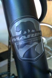
 My partner in crime and I got our bikes and sought to explore parts of town off the beaten path. Art Alliance Austin was hosting an art fair and that was our destination. This is the story of our adventure to the fair and the art we encountered during our trip. Urban biking can sometimes be a challenge, but it’s mostly a fulfilling experience if you take the time to pause and look around. I ride a 2008 Marin Muirwoods. It’s a rugged, steel-framed city bike that allows me to go off-road quite easily. I rode this same bike in Minneapolis, MN, Manchester (UK) and Austin, TX and it has always been reliable.
The trip started a few miles North of the University of Texas at Austin. I am posting the route below along with placemarks of interest along the way. The route was automatically created via MyTracks which is an application for Android-based phones that records GPS tracks. I turned on the application when I started the trip and turned it off at the end of the trip. At times when I wanted to note locations of interest, I added points to MyTracks which then appeared on the map. The final map along with the 8 markers I added are shown below.
Each time I added a marker, I also took a picture. Each picture can therefore be mapped to the marker on the map above. In addition, if you select street view on the map above you may be able to match the picture to the images there (except perhaps in the cases where I was cycling through the alleys!). Geotagged pictures can also be added automatically to a map.
Our first stop was Sparky Park. This is an Austin Energy substation that was converted to a “pocket” park. We found this by accident, but is was quite fitting that we came across it on our way to the art fair!
From there, we rode towards downtown. The trees provided much needed coverage from the sun and it was great riding through the residential neighborhoods and looking at old houses. At some point we decided to cross Guadalupe Street which is one of the main Austin streets and runs right by the University of Texas.
We quickly abandoned the plan to stay on that street because of the number of cars and people that were on it, and got on side streets again. That’s when we came across the following graffiti, celebrating UT Austin’s football team. Now, I’m not really into football, but from what I hear, UT has a pretty good football team with a dedicated following. That’s probably a topic for a different post though!
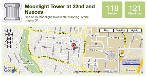
Riding past the university and towards downtown still, the next form of public “art” encountered was one of Austin’s still-standing moonlight towers. These structures were built in the late 1800’s as a way to provide light to the city. Originally, there were 31 of these structures in Austin – nowadays, there are only 15 towers left, while, according to Wikipedia, Austin is the only city left that still operates this system (as part of the “keep Austin weird” program I am assuming! )… To provide more contextual information, I “checked in” at this location using Gowalla.
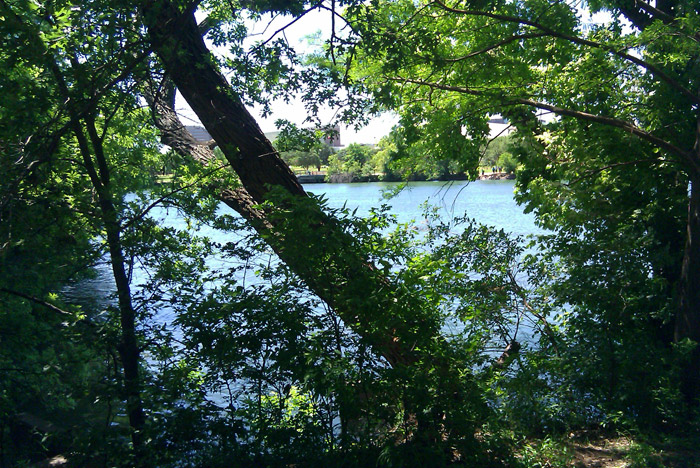
The first leg of our journey ended at Lady Bird lake – which is named after Lady Bird Johnson former first lady and wife of Lyndon B. Johnson. Our very own Learning Technology Center at UT Austin keeps a presidential timeline of the 20th century along with digitized assets and information on LBJ is of course available.
The trip included many more highlights, but this short example provides the main ideas behind designing adventure learning experiences for real-world, participatory, and inquiry-based experiences that capitalize on events that happen outside of the classroom. Literature on adventure learning and these ideas can be found in my publications page.
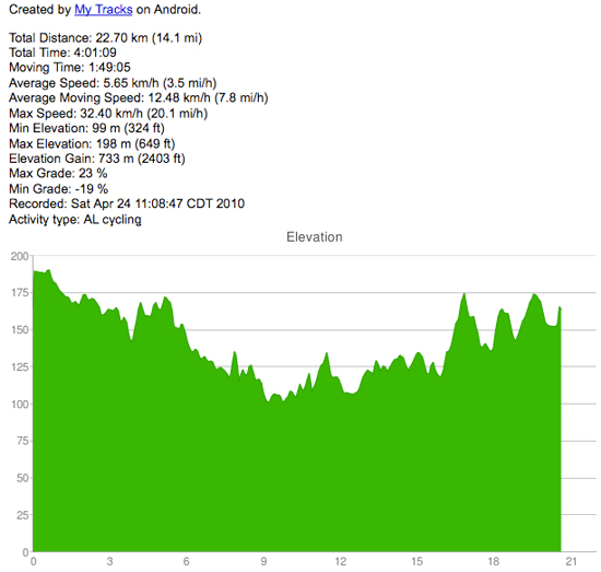
And for those of you interested in data and the use of data to help teach relevant topics, here’s the graph of the trip!


Sonny Andzenge
Simply awesome!
I regularly enjoy the way you breakdown ideas in AL and using technology in teaching and learning to something very basic and relateable to a broad audience.
I’m a fan of your work. Thanks for being inspiring!
George Veletsianos
Thanks for you kind words Sonny! Keep visiting – would love to hear your thoughts on any posts that appear on here.